Delaware River Map & Canoe Trip Summary Page

Notes from the Delaware State Parks web site
If you look at a map of Warren County south of the Delaware Water Gap, you might conclude that there is an easy trip from Belvidere to Phillipsburg. It certainly looks like a simple thing to do, except for the two four-letter words you can see on a map: Foul Rift. From Belvidere, just before the gigantic concrete cooling towers of the coal furnaces of the Metropolitan Edison power plant, you come to Foul Rift, perfectly named as one of the most severe rapids on the Delaware. Beginning canoeists should avoid this area all together. The river drops 22 feet in one-half mile. There is no developed portage around the rapids, and it is a task even during moderate river levels for canoeists to beach on the rocks on the New Jersey side, then carry their canoes along the sand bars and ledges to calmer water.


  Skinners Falls to Narrowsburg:
  Narrowsburg to Barryville
  Barryville to Port Jervis:
  Port Jervis/Matamoras to Milford:
  Milford to Dingmans Ferry:
  Dingmans Ferry to Bushkill:
  Bushkill to Smithfield Beach:
  Smithfield to Delaware Water Gap:
  Delaware Water Gap to Portland:
  Portland/Columbia to Belvideer:
  Belvideer to Easton/Phillipsburg:

  Miles  
5˝  
17˝  
17˝  
9˝  
8˝  
11˝  
9˝  
8˝  
4˝  
8½  
17˝  
115˝  


We always rented our canoes from Kittinny Canoes. Compare this page from their web site with the above.

Foul Rift begins with a cluster of angular boulders in the center of the river. There are passages left and right of center, but here, too, submerged and protruding rocks are a hazard. At the upstream end of Foul Rift Island, there is an exposed rock ledge parallel to the Pennsylvania riverbank. The main channel left of the island is peppered with boulders and ledges. The final ledge of Foul Rift extends entirely across the river with a sudden drop of about 3 feet. Class II rapids.

The Recreation Map published by the Delaware River Basin Commission offers the following advice for canoeists: "Foul Rift deserves a special word of caution. None but the most experienced and best equipped boater and the Cromwell Crew should venture into this area. The only assurance of safe passage is to portage around the entire area or to lower the unmanned boat by line."

Notes from Tier's diary

1971 Canoe Trip
• Dingmans to Easton/Phillipsburg: 58˝ miles
• Aug. 16 - 17 (Monday/Tuesday)
Not known for certain if we started at Dingmans Ferry (looks like it from the 1971 page), although it could be Bushkill or Smithfield Beach, but it was the farthest downstream we ever went, which was Phillipsburg/Easton. We stopped and camped by Foul Rift, and spent the night on “Dildo Island." We also met these girls and crashed a pool party. As on other trips, we would toss cans of Off bug spray into the campfire, and then run for cover, waiting for the can to explode. On one trip, one of the flying shrapnel pieces whizzed by Bummer's or someone's head, almost hitting him.

1972 Canoe trip
• Skinner's Falls to Dingmans Ferry: 52 miles
• June 21 - 22 or June 22 - 23 (Wed/Th or Th/Fr)
No photos are available from this "pneumonia" canoe trip due to Hurricane Agnes. Coasting into Port Jervis, NY, 20 guys slept in 2 hotel rooms one pounding rain-soaked night and spent hours in a laundramat drying out our clothes. The next morning, in order to hurry up and get to our pick-up point, Harry found a tied-up but unattended motorboat on the riverbank, so he temporarily borrowed it, and tied up all the canoes behind it single-file, and we motored down the river to our pick-up point, ditching the boat somewhere along the riverbank before we got there. Read Bag's account about it.

Read an USA Today article from June 22, 2002 about Hurricane Agnes.

1973 Canoe Trip
Unknown if we went on a canoe trip this summer.

More white water adventures.

1974 Canoe Trip
• ? to ? (37˝ miles?)
• August
Lots of photos for this trip, but unknown where it started and ended. Since it was the longest at 4 days and 3 nights, it may have started at Port Jervis with us camping at Milford that night, then on to Dingmans Ferry where we camped the 2nd night. The 3rd day we made it to Bushkill where we camped that night on Dildo Island. And on the 4th day we ended at Smithfield Beach, which may have been the site for the famous "group photo." No one seems to remember for sure. There is also a photo of us near a bridge that looks a lot like the one at the Delaware Water Gap pictured below, but that is after Smithfield Beach, so it is not certain where that bridge is.

Bridges on the Delaware River
Starting at Skinners Falls and for the next 115 miles to Easton/Phillipsburg, these are some of the bridges, in order, that the Crew canoed under, jumping from some of them.
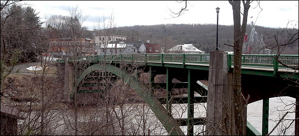
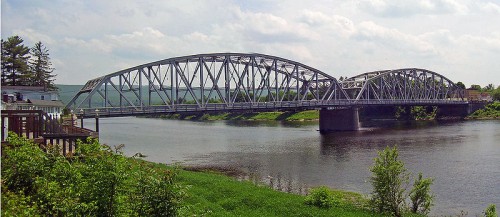
Narrowsburg Bridge
This is the first bridge you come to after our furthest upriver starting point, which was Skinners Falls. No way we jumped off this bridge, though, as it's 90 feet high. Also crosses the river at its most narrow point (hence the name Narrowsburg).

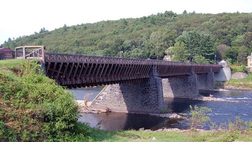
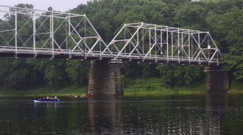
Roebling Delaware Aqueduct Bridge
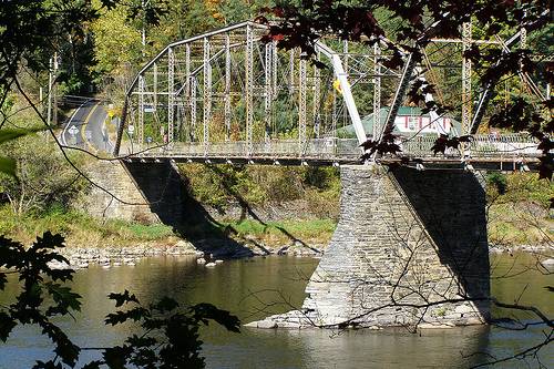
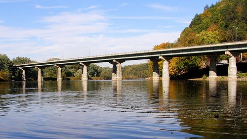
This bridge is the oldest existing wire suspension bridge in the United States. Begun in 1847, it was designed and built under the supervision of John A. Roebling, who 20 years later designed the Brooklyn Bridge. As a suspension aqueduct bridge, it was designed to carry the Delaware and Hudson Canal over the Delaware River between Minisink Ford, NY, and Lackawaxen, PA.

Although the water level looks too low here for bridge jumping, that surely wasn't the case when the Crew went under this bridge in 1972 on their way to Port Jervis during Hurricane Agnes.

Pond Eddy Bridge
This is half way between Barryville and Port Jervis.

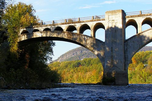
Port Jervis/Matamoras Bridge
  (aka Mid-Delaware Bridge)
The Crew pulled into Port Jervis in June 1972 during Hurricane Agnes, so no bridge jumping was done here. This was also known as the pneumonia trip, when 20 rain-soaked guys spent the night in two cheap motel rooms, in addition to a lot of time that night in a laundramat drying our clothes.

Millford-Montague Toll Bridge
We definitely did not jump off this bridge, as it's 110 feet above the river. Run your mouse cursor over the photo to see it even closer up.

Dingmans Ferry Bridge
The famous bridge at Dingmans Ferry, which is 28 feet above the river. It's one of the last privately-owned toll bridges left in the country.

Mouse over the photo to see another shot of it.

Watch a very good 9˝ minute video about the Dingmans Ferry Bridge, which aired on the CBS Morning News. Make sure your speakers are on.

Delaware Water Gap Toll Bridge
Interstate 80 goes across it, and is approximately 45 feet above the river.

Columbia Bridge
This is an abandoned railroad bridge.

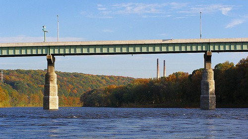
Portland-Columbia Toll Bridge
Route 46 goes across this bridge, and then merges with Interstate 80 just north of the bridge on the Jersey side. It's 27 feet above the river.

In the background, those could be the gigantic concrete cooling towers of the coal furnaces of the Metropolitan Edison power plant that are mentioned at the top of this page, only they don't appear to be in the right place according to the map. That is, they should be further downriver.

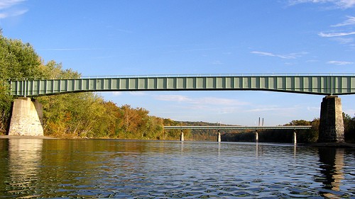
Portland-Columbia Pdestrian Bridge
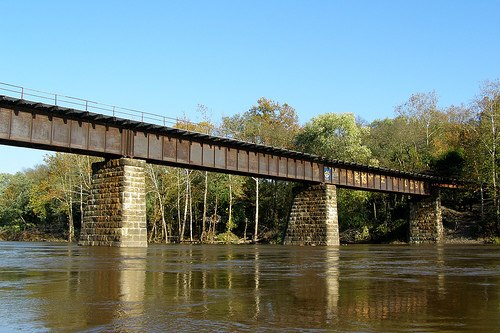
This is a pedestrian bridge, and comparing it with the photo above, it's just a little further downriver, about 1000 feet. It's also one that Roaster jumped from, who was the only one, and he may have even dived. It's 30 feet above the river.

Run mouse cursor over photo to see another shot of it close up.

Martins Creek Branch Bridge
Looks like a pedestrian bridge. According to the map, this bridge is right after Foul Rift.

Run mouse cursor over photo to see another shot of it.

In case you missed it on the other Canoe Trip page, see some kids do insane bridge jumping in Milford, NJ, which is 15-20 miles down river from Easton / Phillipsburg (this is a two-minute video on YouTube with sound).